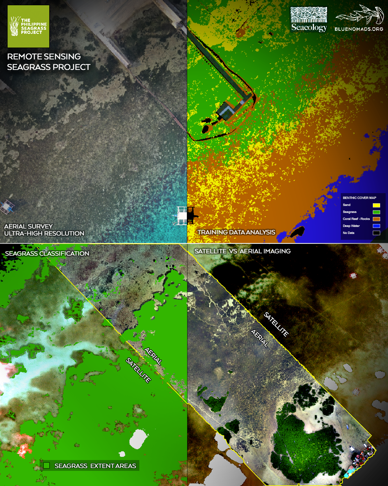
This project will map almost 750 acres of seagrass in Cebu Province, around two islands that are popular destinations for birders and snorkelers. The data gathered will be made available through a free phone app, allowing boat operators and local communities to avoid damaging crucial seagrass.
Protecting seagrass, which a recent study called “one of the most productive ecosystems in the world,” is a Seacology priority. Seagrass provides habitat for sea turtles, dugongs, and commercial fish species. It makes water cleaner and stabilize the sea bottom. And it captures and stores carbon at a rate several times that of terrestrial forests.
But seagrass, which grows in shallow water near shore, is vulnerable to damage from boat anchors, dredging, and sediment from coastal development or agriculture. It is being rapidly lost around the world.
This work follows directly on the success of two similar mapping projects, in Spain’s Formentera Island and Puerto Galera, Philippines. Data from the Philippines is available through Seagrass Maps PH, a free phone app. Boat crews can use it to avoid dropping anchors on seagrass meadows, and villages in the area can take the data into account when they make planning decisions.
A local company, BlueNomads, will collect data using aerial surveys, underwater imaging equipment, and high-resolution satellite cameras. The app will be promoted, with a broader seagrass conservation message, through social media and outreach to dive operators, tour guide associations, and boat charter companies.